
Ballinastoe
Forum Messages
| Author | Date | Message |
|---|---|---|
| John Barry | Jul 4 2008, 9:30am | For Brendan Aurthers or Rachel Cinnsealach: Because the route is so long I want to do the race marking early. Possibly on Tuesday evening. Anton Wigley is giving me a hand. (GPS / OziExplorer / GoogleMaps etc etc etc) In order to do this I need the race marking material. Any chance of getting that some time on monday? My idea is that one or two people (on bikes?) can quickly check the route on Wednesday evening before the race. You can get me on 087 6zero5 8zero95. or JohnJosephBarry AT gmail com /John |
| Justin Rea | Jul 4 2008, 11:31am | Good luck! Marking this route took me over 4 hours. You need to know the route well. Not sure what cross over there might be to MB trails now as well. They should probably be avoided if possible. We had trouble with people moving markers even having done the marking immediately before the race. It's a good idea to check it. I bought lots of rolls of tape earlier in the year, so there should be plenty left. |
| John Barry | Jul 4 2008, 12:41pm | Famous last words from me Justin. But Anton & I think we have it in hand. We just need to find the Garmin Data cable to get the route onto the GPS. We going to Cycle / Walk it Monday and then hopely mark it Tuesday. With a final Check around 5ish on Wednesday. /John |
| Mick Hanney | Jul 4 2008, 1:35pm | John, The marking stuff is in my car from a handover I took on Weds at Sorrell. Do I need to meet you before you venture out on Tuesday, or do you have your own tape rolls? Regards, Mick |
| John Barry | Jul 4 2008, 2:22pm | Mick, If it's handy to see you on Monday around lunch time I'll do that. Else I'll pick up a roll or two myself. I'm working in Clonskeagh (Ericsson). You anywhere close by? /John |
| Alan Ayling | Jul 4 2008, 2:26pm | John, The new mtb trails are not marked on the o-map on the site, it's an older version, but they should not impact significantly on the course or the marking. The course will cross the mtb trails in a couple of places - I'd suggest use the small markers leading away from the crossing to mark the route rather than taping across the MTB trails, as tapes across the trails might get moved. Also there has been some felling - if you look at the map, the second last long straight (running roughly E to W in the forest), the a large block to the left (south of the trail) is now nothing but matchsticks. However, the race route trail is fully passable there. Finally, the route shown at the very southern tip of the map is NOT the same as that we've run in previous years. At the end of the infamous mucky ride, the map shows a wiggle - the race route has actually continued straight down alongside an old ruined fence all the way to the egde of the forest, where it swings left and follows the forest boundary, just inside the forest - a sweet little trail that you'll find OK on the ground. Just follow this until it joins the fire road. Turn right, follow the fire road for maybe 80 or 100 m then left onto the trail marked on the map as a dotted line; down to the lower fire road; from there pick a line as best you can to the river crossing. Hope this helps. Would volunteer to help mark only I'll be away. Alan. |
| Tony Kiernan | Jul 4 2008, 3:05pm | John, Coillte have requested that the race route keeps off the MB Tracks and that any cross-over?s with the MB Tracks are marshaled to safe-guard against any collisions. Tony |
| John Barry | Jul 4 2008, 3:32pm | I suppose the Race director will make final decision on the route because of the Mountain Bikes? |
| Mick Hanney | Jul 4 2008, 4:39pm | John, I'm based in Cabinteely but on leave on Monday. If you gave me a buzz I could meet you at Ballinastoe Monday evening perhaps. Cheers, Mick 086 8539554 |
| Rachel Cinnsealach | Jul 4 2008, 5:29pm | Hi John, Sorry I'm only getting this message now. Can you give me a ring on 087 2561906 if you need extra help, or if you have any queries. rach. |
| gerry brady | Jul 6 2008, 6:20pm | As a trial to gauge interest, the Committee has agreed to give prizes to the winning women's and men's county teams in the last two Leinster League races (Ballinastoe and Sugarloaf). Same rules and prizes as clubs competition. County results have been added to the results pages of the previous LL races and different runners have made the scoring county teams to those making the winning club teams. Would be great if everyone would give their county to the laptop operators at registration especially those runners who are not already in clubs. ideally use your county of birth to get a good spread but county of residence is also okay. |
| Eoin ONeill | Jul 8 2008, 7:47am | Hi,I\'m looking for a lift to Ballinastoe from the city center - if anyone can oblige can they reply to this post please? Thanks Eoin O\'N |
| Roisin Kelleher | Jul 8 2008, 9:03am | Eoin, I am driving from the city center to this event. My car is registered in the Carpool. I won't however be driving back to the city center, I will be going home on the M50 towards Terenure but I can drop you at a Bus stop, Roisin |
| Eoin O'Neill | Jul 8 2008, 6:03pm | Thanks Roisin, I have a lift now |
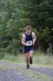
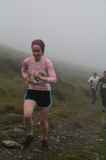
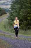
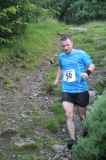
| Justin Keatinge | Jul 9 2008, 9:44pm | Thank God for creating Paul Mahon. We'll never know how many women have uttered that statement over the years, but today I joined their ranks. The Ballinastoe route created by Paul is just awesome, even better than the excellent bike route in the same forest. It had just about everything that a Wicklow hill could throw at us, from hard rides up and down, to muck and shite, dark forest, some open mountain and a river crossing. It was an extremely difficult course to mark, so well done to the race director Brendan and the race markers. Those of us in the middle of the pack are not used to having to follow the markings and a few got lost, but the organisers can't be blamed for that. Truly a magnificent night out. A run up Djouce would have been a very poor substitute. Justin |
| John O'Regan | Jul 9 2008, 10:34pm | Have to agree. I got lost and DNFed but it was a great race and a memorable night out. John |
| Mick Hanney | Jul 9 2008, 11:26pm | The first 46 photos loaded are around the river crossing. Camera phone quality but interesting nonetheless. |
| Eva Farirmaner | Jul 10 2008, 8:56am | I too loved the race last night and thoroughly enjoyed the mud and the other rude stuff so eloquently penned by Justin! A huge well done to Brendan, John and the team on all the organisation and hard work they put in which made it such an enjoyable night. Thank you too to the gentleman (I hadn't the energy to look up!) who offered a helping hand across the raging torrents of the river! On a personal note I want to thank Niamh Ni Cholmain for her sportsmanship - I was in front of her (a rare thing on a descent) along with Liz, Eileen and Daniela and had to shout for assurance we were taking the right path. Further on Niamh again corrected us near the final descent when Liz and I were about to take the wrong path so a big thanks to our pal. Roll on the Sugarloaf and here's to another great night. |
| Marlon Davies | Jul 10 2008, 9:10am | What an evening! And the pictures to prove it! Well done to those who organised an excellent race and marked a difficult course. A special thanks to whoever it was that helped many of us cross the river with a steady hand. The races have kept getting better and better and I am now looking forward to Sugar loaf. I continue to be impressed with the dedication of organizers and volunteers -appreciating the effort having helped with one -will do so again soon. |
| John Barry | Jul 10 2008, 10:23am | Hi all, I was heavily involved in the marking of the majority of the course and it was interesting to see how things panned out during the race. I was whacked during the race but after walking 5K of the route an hour before the start probably didn\'t help! Thing to note was the forest (best and most fun part of the route I thought). A group of people were running 30 to 50m in front of me and the leaders were looking down and you needed to do because of the ground. As a result they couldn\'t/didn\'t see the markers and slowly veered right and wrong. A timely shout by \"the Knight in shining amour\" they made there way back on track and I quickly lost the dozen or so places I made. Note to SELF: Paint a Yellow Line on the ground next year! |
| Mark O' Sullivan | Jul 10 2008, 10:57am | Hi, Ya, I agree with John Barry. I turned right instead of left and met a lot of runners who had previously done the same thing. Anyway, we should remember the difficulty of marking a course like this and be grateful to the organizers and markers who do a terrific job week in, week out. |
| Mick Hanney | Jul 10 2008, 1:35pm | Justin - sounds like you have the core of a good race report there. Did anyone record the distance / climb for the route (no wrong turns made!), to ensure the event details are accurate? |
| Aaron O'Donohue | Jul 10 2008, 1:47pm | Distance 11.4KM I will revert with altitude gain. |
| Dermot Murphy | Jul 10 2008, 1:54pm | I also recorded a distance of 11.4km. Total altitude gain - 550 meters. |
| Rene Borg | Jul 10 2008, 1:56pm | The current distances were measured last year with my Garmin with 11.41 and 538m of ascent. So if the route remained the same measurements from this year should be about the same. |
| John Barry | Jul 10 2008, 2:48pm | Rene, I think the route was slightly different because of the cut away forest after about 5K. I think we were forced a small bit more south that left a slightly longer run up to the river(Very handy for washing dirty laundry and shoes!). It would have added a few more metres. But then how accurate is a GPS running through forests? /John |
| Rene Borg | Jul 10 2008, 2:58pm | Hi John, modern GPS would be very precise. Only the heaviest tree cover would be able to block the signal. Also, the GPS would be fooled by height if the transmitter hits a tree, but when you load the software into Motionbased, it automatically corrects your height readings by official height readings from the navigation points that your GPS has recorded. Having re-run routes and used the GPS on the track, I would say with confidence that the modern systems are almost bang on. |
| Maik Erler | Jul 10 2008, 3:16pm | Rene/John, my Garmin Forerunner recorded 11.38km and I first thought there must be something wrong as the event details stated 12.5km as total distance. I think somebody corrected that to 11.41km. So I'm pretty impressed with the accuracy. Minimum Elevation: 322m Maximum Elevation: 572m Elevation Gain/Loss: 799m/-805m (I'm not so sure about these figures...) Well done and a big thank you to all the organizers/volunteers as I too enjoyed yesterdays race. Maik |
| Mick Hanney | Jul 10 2008, 3:39pm | Good times considering the distance and conditions. Great placing by Erin as first woman home. Consistent with the placing by Aisling last year. |
| Rene Borg | Jul 10 2008, 4:05pm | Hi Maik, your distance would be accurate. However, your elevation figures have been skewed by the trees as far as I can see. If your software allows for auto-correction of the elevation readings, you should enable that. I constantly got crazy readings off my training runs in the city because the GPS picked up buildings, until I used the autofix which would assign the correct height for the overall area instead. |
| Marlon Davies | Jul 10 2008, 4:16pm | Wierd....my Garmin marked 12.23 km but I was part of that group that got lost a little bit. I didn't think it was that far though. I did have some problem with signal in the forest but it never cut out completely. |
| Eoin O'Neill | Jul 10 2008, 6:22pm | I recorded 11.13km and 552m ascent. Probably closer to 11km exactly since I went off-route several times... |
| Paul Mahon | Jul 11 2008, 8:30am | It is great that the techno geeks have not got all the same exact distance and elevation gain / loss or there would be nothing to debate :-)! Personally speaking I think there is something appealing about the nature of hill running races when the distance and climb are not always a complete reflection on the difficulty of a course and where prevailing weather and ground conditions can all play their part. For me there would be no real fun in a race where it was all about your mins per km/ meter gained or the likes - there is plenty of opportunities for that in the road race alternatives with your stable diet of 5 miler and 10 k?s all around the country which clearly do appeal to many. It is good to know that the "Ballinastoe Bliss" race seems to have been generally well received. In retrospect I guess it might have been useful to refer back a couple of years to a pre race "Caution" of what this particular race was all about - " Race will be on a similar circuit to last year with shoe sucking mucky ride, low tree branches and ankle twisting rough ground in places. Route has been improved by use of some bike tracks in preference to some of the darker forest and fire road sections Something for all mountain runners to enjoy". The strong flowing stream and the deeper than usual mud were just nature having it?s hand in the ?fun?! Congrats to first time Director Brendan and his Team of markers in particular for their keeping this race on track despite the difficult ground conditions caused by the recent wet weather :-) |
| Rene Borg | Jul 11 2008, 8:47am | it is an interesting nature of hill running that no two runners will actually ever run exactly the same route (it will depend on how you cut the corners etc.). Because of that, good route choice can save you several hundred metres even on a fully marked course. On the race itself, all this feedback will be very welcome and I urge everyone else to voice their opinions (positive and negative) for the Committee toe hear. As Coillte will keep hacking away at the route over the coming years, and it took the marker team more than 4 hours to mark the route, and strict marshalling was necessary to keep it under control. In general a mammoth task for the volunteers. For all the success and fun factor of the route (and I enjoyed it very much last year), these other factors weigh heavily against the route and must also be considered before a decision is made on whether the route is actually sustainable for next year and the years following. So again, I have received most feedback from helpers via email, but if there is more to be added, please send it along. |
| Paul Mahon | Jul 11 2008, 11:29am | I think that on a fully marked course there is only a minimal amount of advantage on route choice to be gained. Mainly this has to do with finding better ground conditions which might actually add to the distance but save a precious few seconds. A great example of that was to be seen last year when the Kippure handicap winner had receed the route the previous night to find the best terrain. On the open mountain unmarked courses there are definite route choice advantages to be had - like John Lenihan's higher ground route near the hydro dam on the Carrauntoohil or the straight line vs sheep track option on the Scarr ascent in the Glenmacnass race - these are all perfectily legitimate and reward those who take the time to prepare fully for such races. Anything to do with short cuts that save you several hunderd meters on a fully marked course would call into question the integrity of the runner - might even be a case of having a post race check of gps type devices where available :-) |
| Paul Nolan | Jul 11 2008, 11:42am | Or my favorite when younger and stupider, the straight line from church to shoulder off the Reek. |
| Rene Borg | Jul 11 2008, 11:44am | Rumour has it that a record attempt of ascent/descent of Lug could be attempted following the straight line down the North Prison. I am sure a Garmin could eventually be recovered and restored to measure the exact speed of the runner. |
| Rene Borg | Jul 12 2008, 1:51pm | Club results are now up. |
| Rene Borg | Jul 13 2008, 12:17pm | Anyone for a race report, mail to rene dot borg at imra dot ie and I will post it. |
| Mick Hanney | Jul 13 2008, 5:24pm | Tuh tuh Rene. At 12.17 today you should have been jogging up Mount Leinster with the rest of the die hards. :-) |
| Rene Borg | Jul 13 2008, 9:49pm | I should! But its starting to be so soul-destroying not being able to descent that I keep away now until I can heal my darn feet! Glad to hear the route was well-received so it hopefully returns next year where I will either be back or have purchased prosthetic feet! I think I may change my name to "Glassfoot", no way "Glassfeet..." |
| Eoin Keith | Jul 14 2008, 11:38pm | Just a few comments on Ballinastoe.... Its a brilliant course. Everyone who I talked to afterwards who expressed any opinion absolutely loved it. It would be madness to even consider abondoning the race. The route itself is turning out to be very clever in unexpected ways. It manages to avoid the new mountain bike trail bar a couple of metres here and there, which is impressive. I had no one else to follow on the race route, and I found it straightforward enough to follow. If anything, it was over-marked. There were plenty of markers on parts of the course where the natural route was an obvious path. Markers in these places shouldn't be necessary, but were put there anyway, so fair dues to the course markers. It was a massive effort. There is an onus on everyone to know where they are going themselves, whether the race is marked or not. If I go wrong on a race the first person I blame is myself. There are a lot more markers on race routes now than there were when I first started hillrunning. If this makes the task of organising the race then try cutting back on the marking. Race maps have never been better than they are now. |
| Rachel Cinnsealach | Jul 15 2008, 2:47pm | Folks, There is a small section of this race that was not demarked. -The light faded and the people demarking didn't get to remove all the tape. Is there anyone about that would like to have a re-run though the forest, and take down the rest of the tape? rach. |
| Mick Hanney | Jul 15 2008, 8:20pm | Hi, I called by on the way home from work and removed the offending sections of tape inc. 2 signs. Regards, Mick |
| Rene Borg | Jul 16 2008, 8:24am | Hi Eoin, a bit more than 11km sounds precise. The people who recorded a bit more than 12 were those who veered a little wrong (as Marlon mentions and Mick has confirmed to me later watching the race). I think I made a tiny mistake myself (double-backing a hundred metres) during last years race explaining why I got a few hundred metres more. One thing I've learned in IT: Don't blame the machine, blame the man! Race report is up btw! |