
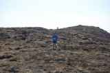
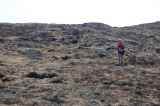
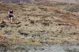
Black Mountain
Forum Messages
| Author | Date | Message |
|---|---|---|
| Kevin Moran | Mar 28 2010, 10:56pm | Is their an online registration? |
| niamh o ceallaigh | Mar 29 2010, 7:45am | No pre registration for this race. Just turn up on the day. NIamh |
| Dermot Murphy | Mar 29 2010, 1:14pm | Volunteers required for the race - can I please have some volunteers for the Black mountain race? A couple for registration (can run) and some non running volunteers for the race finish and Marshals. |
| Paul Brew Crew | Mar 29 2010, 11:27pm | Hi lads, We will be at the race and were wondering if there was anything that we could add to our menu that might be needed on the day. We'll have the usual teas, coffees, rolls, sandwiches, etc. Dermot, we'll look after the marshals on the day with tea, soup, sandwich, etc if thats ok. Regards, Paul. |
| Jason Kehoe | Apr 7 2010, 5:39pm | I'm guessing that's a typo above about the short race being 9.7km? I've run a few of the Leinster and Irish Champ. races but has IMRA published a list of rules / regulations for the LC and IC races. Especially around the marking of the courses and whether they are point to point or certain points must be navigated etc. I haven't been able to see any on the site except for a paragraph on the respective league page. Would be handy to know for doing recces. Like for BM do you have to stay to the indicated fireroad or is it up to the individual once they navigate certain summits. For the LC it says: "As a rule they are not marked and runners would be expected to be able to find their way from a published route." Black mountain and Mount Leinster are usually marked quite well, so just curious on what the stance is and whether it's up to the RD or what. Thanks. Jason |
| Diamuid O'Colmain | Apr 7 2010, 6:30pm | Yes Jason it is not at all obvious that the race is actually 15km long unless you check the map. (I thought it was going to be a nice short easy race, but I was thinking of Round Mountain, and misled by the 9.7k in the event details). Of course, only a nerd like myself who is prepared to navigate the course on the understanding it is not marked would bother checking and printing off the map! In recent times there has not been a standard approach to the marking/not marking of championship races. My personal preference is for them not to be marked, but I know that some good arguments (but not good enough to persuade me!) have been made to argue the opposite. |
| Niamh O Ceallaigh | Apr 7 2010, 11:08pm | Hi Jason, This is an item that is being discussed at the committee meeting tomorrow. I will post the outcome. The current situation is that it is up to the race director to decide on the degree of marking and to publish this information in advance of the race. This applies to mandatory kit also. I will be race director for Tonelegee and the Lake. There will be no marking. The requirements will be that runners run to the top of Tonelegee, around the lake (anticlockwise) and back to the summit of Tonelegee before running to the finsh. The route competitors take is entirely up to them, so route choice is important. There will also be a mandatory it requirement including map, compass, whistle and rain coat. Niamh |
| Gerry Brady | Apr 7 2010, 11:10pm | Eamonn McMahon is going to mark the course. The route is such that it is designed that you follow the markings as otherwise there are endless shortcut options unless compulsory checkpoints were introduced. Surprisingly the route is not too wet given all the recent rain. If there is a mist (as in 2008) then visibility on the open mountain could be down to 50 metres. Mist caused the short route option to be used for all runners in 2008. |
| Jason Kehoe | Apr 8 2010, 1:40pm | Diamuid - Darn I was expecting it nice and handy too even though I remember running the 15km last year, I was hoping the typo should have been 6km or so! Niamh - Thanks for that I would be interested in the summary of the meeting. Your description of T&TL is perfect and to narrow it down even further, short as it is, you could even throw in the grid references and specify whether the map of the race route is sufficient or an OSI map. Maybe we could do something similar on all IC and LC race pages. I'm probably coming across as pedantic but I can see the route you have marked out which is a good indication of the general race line recommended and you state that route choice is up to competitors but other races like Carrantuohill have a similar high level map yet it's not stated anywhere (that I can see) that its a point to point race and optional route choice and I suppose what really compounds my annoyance is I don’t know where John Lenihans 'secret shortcut' is! But I find that’s the beauty of IC and LC races that skill and route choice can be a factor. So like JL if I feel that I can use skill and route choice to shave places/seconds off my run on non compulsory sections then it makes the races more exciting. I just hope I could see this in writing somewhere rather than having to ask the question every time like a broken record. Like how far is it ok to stray off the path - 5m, 20m, not at all if it gives you an advantage! I'm sure some mightn't want to go down this 'path' of rules but no harm in discussing. Maybe have a general list of rules that RD can choose from to apply to their race. The league page hasn't been updated yet so I'm not sure who the League Directors are. I'd like to suggest though that the IC and LC race pages should have all the required information (mandatory kit, maps, grid references etc.) published at least four weeks in advance to allow potential entrants to recce the routes and also ensure they have the required gear and the skills required to use them. These details are obvious for experienced runners/navigators but for people wanting to try these races for the first time it is not so obvious, especially if they were to just find out less than a week from the race. Saying all that, I find on a clear day these races are quite straightforward but its when the mist comes down and you’re by yourself that you need to be prepared. Hopefully we will see more runners giving the odd one a try. They are fantastic races and it's a great way to make a weekend out of it for races further away and at the very least an exciting day trip. Thanks, Jason |
| niamh o ceallaigh | Apr 9 2010, 9:52am | Hi Jason, The matter of marking of Champ races was discussed at the committee meeting last night. It was decided that each race needs to be considered on an individual basis. For example, at Black Mountain, runners must follow a marked route. However, at the Circuit of Avonbeg, runners may find their own route between the mandatory peaks. We will endeavour to update event pages for all Championship races in the next week, clearly stating the requirments for each one. Niamh |
| Peter O'Farrell | Apr 9 2010, 1:45pm | On a misty day on the open mountain with your head down and your arse up mere markings will not contain eager beavers. In championship weekend races you should expect to have to use the map and compass and more usefully - be able to use it... Black Mountain was marked last year and the three lads around me all managed to go down different gullies getting back onto the flattish bog before the forest edge on the way back - that was on a sunny clear day. Niamh's very generous offer of nav training on Tonleegee is a great idea for anyone interested in allowing finish marshalls have an easy job of it. Some of the Adventure Racing guru's also run nav training courses I think. Orienteering clubs provide a different kind of navigation training but some is better then none :) what is 5 multiplied by 2 indeed! |
| Brendan Pollard | Apr 10 2010, 12:19am | As a complete newbie and novice to IMRA I have nothing but good things to say about organization, those who volunteer and all other runners. My first run was Sugarloaf in December and I am still in awe at how well races are run and how cheap they are to participate. The real point of my comment though (from a novice perspective) is that I would have great concerns over participating in any race that had not got some markings on it. I maybe missing out on the enjoyment aspect of navigating but my enjoyment come from the scenery and just pushing myself running in the races. Personally speaking I would feel like I had an unfair advantage somewhat if I used my navigation skills to find shortcuts to course as defined. Maybe I just need to spend some time learning some skills in map reading and navigating. I am already concerned about finding race location on Sunday don’t mind navigating the mountain and bogs :> My other problem is that I wear glasses but run without so I would have to carry glasses if I had to use/refer to map or compass. Just a novice point of view. Thanks again to all involved in setting up and running events. |
| Colm Moran | Apr 10 2010, 1:20am | Hi, in terms of running with glasses, depending on your sight dificulty.. you can get a magnifying glass attatched to your compass.. And the orienteering club navigation is the best type :P you'll learn to read the map at speed and get good at routechoice options! |
| Diarmuid O'Colmain | Apr 10 2010, 9:15pm | Regarding Navigation, there are different opinions. For what it's worth my tupppenceworth is as follows: Leinster Leagure and Winter League races on relatively low and easy hills are always well marked (doesn't stop people going wrong, especially in bad weather) and you are not required to be able to navigate to participate. Championship races vary in character but in principle are on mountains (higher and more rugged than 'hills', with the possibility of not having a path to follow). Anyone who goes mountaineering or plain mountain walking should expect to be able to find their way unless they are part of a group with a leader. Irish hills are deceptivey dangerous - people do die on them every year, and even in summer time, weather conditions can occasionally be very challenging. My view is that anyone participating in a championship race should be a competent navigator on the race route they are attempting. The number of people participating in championship races is typically quite small and it is not reasonable to expect the Race Director to provide detailed marking, which, for a long race is very onerous indeed. Effectively to provide such marking on e.g. a 15k to 20k route means that at least one person, possibly two, who would like to participate in the race, cannot do so. In reality, the numbers involved are greater, since you normally need some marshalls, if you cannot depend on people to find their way around, notwithstanding presence of markers - see Peter's comments. I do appreciate the wish on the part of people without navigation skills to participate in the championship races,and there are definitely some (even classic routes like Croagh Patrick) where this is possible. But why not see this issue as an opportunity to develop a new skill. Navigation ability opens up a whole new range of opportunities to enjoy the hills and mountains. Regarding glasses, this is an issue for anyone in the hills, and is a problem I am very familiar with - personally I use contact lenses (daily disposables) and they are very successful for me, and not expensive. |
| Colm Hill | Apr 10 2010, 9:37pm | Now seems like the ideal time to plug the CNOC Summer Series! Its a series of easy navigation races been set up in and around Kildare/ Wicklow in the coming weeks. Navigating isn't hard, but for some reason Hill Runners seem *scared* of it and see it as the big bad bogey man ;) See orienteering.ie for full details |
| Brendan Pollard | Apr 10 2010, 11:32pm | Hey Diarmuid, Colm, Looks like contacts is the way forward for me considering I found out today laser not going to resolve the eye sight issue. Agree with you too - anyone in my position that is nervous about navigating there way through an unmarked race should really consider improving their skills in orientering. This is a skill I do plan to develop as it would be a sin to miss out on any races that are pure enjoyment to me for this reason. Looking forward to tomorrow and good luck to all. Oh before I forget, if anyone requires a lift in the morning i will be leaving from Glasnesvin\finglas areas in morning heading to Finglas exit on M50. My mobile is 0868178657. Bren |
| Colm Moran | Apr 11 2010, 12:28am | Although CNOC is not my club, I would agree with Colm H as the CNOC summer series are a great set of events to learn to orienteer at.. |
| Diarmuid O'Colmain | Apr 11 2010, 6:51pm | Congratulations to Dermot Murphy et al on a great race today. Wonderful weather, a very nice running route, a homely,friendly (and small, like the old days) crowd. And, I have to admit the experience was all the more enjoyable because it was so well marked that you didn't have to spend time navigating! So thanks to those who did the mammoth task of marking, demarking and marshalling. |
| Jim Fitzharris | Apr 11 2010, 8:01pm | Hear! Hear! The course was very well marked - quite a feat for a long open mountain course. Brilliant route and great views, no doubt helped by the halcyon weather. Full marks to Dermot, Niamh and all the volunteers. Only my second champsionship race but highly recommended. Cheers, Jim. |
| Jason Kehoe | Apr 12 2010, 1:53pm | Whats all this about a Connaught man winning a Leinster championship race??!! Well done Brian super run and a new course record! Peter will be out to get you for sure next time. Also Denise Ryan who was first lady and missed out beating Mags course record by just four seconds! Thanks to Dermot and Brian and helpers for marking the course the day before and for the rest of the volunteers for making a great Sunday afternoon. The cool stream and cooler beer went down great afterwards too on such a sunny day. See you at Tonlagee for what should be a cracker! |
| Dermot Murphy | Apr 12 2010, 2:15pm | Results and race report now up. |
| Jason Kehoe | Apr 12 2010, 3:12pm | One more thing about the distances, I clocked it at 15.1km with 570m Elevation gain. Anyone else get similar results? It looks like the details pages is a fair bit off with the ascent amount anyway. |
| Kevin O'Riordan | Apr 12 2010, 3:38pm | GPS isn't very accurate for measuring elevation. You might need to use elevation correction software to get a more accurate result. I think Garmin Connect does this for you when you upload your route. |
| Colm Moran | Apr 12 2010, 4:19pm | i got just under 15k.. and yes the garmin elevation is supposedly very innaccurate.. emm.. i was wondering if my club could be changed? i run for both Rathfarnham WSAF and 3ROC and feel i may as well put rathfarnham as my first team as nobody else tends to run for 3ROC..? Thanks, Colm |
| Kevin O'Riordan | Apr 12 2010, 5:00pm | Yeah no hassle. Just changed that for you. -Kevin. |
| Jason Kehoe | Apr 12 2010, 5:07pm | Hey, With Garmin Connect online I get 570 meters with Elevation Correction enabled and 551 meters with it disabled. Mine is the 310xt, I'm just getting used to it but a difference of over 200m seems kinda excessive! Max and min elevations seems to be correct anyhow. Elevation Gain: 570 m Elevation Loss: 565 m Min Elevation: 89 m Max Elevation: 502 m Jason |
| Gerry Brady | Apr 12 2010, 11:14pm | Jason The original gpx file gave 787m climb but Rene Borg has elsewhere documented problems with Garmin's climb calculations. I read the original gpx file into Sportstracks and got 677m and 15.07 km. Both give correct start height of around 100m and summit height of around 500m so the ups and downs on the ridge run are the issue. Could you read your gpx into Sportstracks? Anyone else got a climb measurement? Well done on your run and also to Brian who had a great run and to Denise who made huge improvement since Maulin. The Mournes across the Lough do look tempting! |
| Rene Borg | Apr 13 2010, 4:35am | I’m trying to figure out more about the current status of Garmin Connect vs. Sportstracks. Garmin has gotten the correction feature from Motionbased fully implemented in Garmin Connect now which should, on paper, make for the most reliable measurement (as that technologically replaces your own height readings with the official measurements for the tracking points you have recorded). I need to look at more data (I’m uploading all activities in both tools now) but so far Garmin Connect appears more reliable in forested areas (Sportstracks seems reliable on open mountain, but for readings in Clara Vale, Devil’s Glen and the forest reservoirs here in Singapore the measurements are way off). |
| Dermot Murphy | Apr 13 2010, 9:24am | On sportstracks, I got 15k for distance (pretty much agreed on that) and 635 meters of a gain (630 meters loss). The Garmin training centre (which I do not think is accurate for elevation at all) was 714 meters gain, 705 loss. I use a Forerunner 205. |
| Rene Borg | Apr 13 2010, 9:32am | The technology used on Garmin Connect now is Motionbased Gravity btw. You can read about how it works here: http://wiki.motionbased.com/mb/Gravity |
| Jason Kehoe | Apr 13 2010, 10:00am | Read the GPX into SportsTracks. Interesting results: I get 14.99km for distance with a Elevation of: +567.2 / -563.3. |
| Colm Moran | Apr 13 2010, 8:29pm | cheers Kevin |