
Nav challenge 2 - Glendalough ("Leg 5")
Authors
Gavan Doherty
09 September, 2013
split times in detail (with analysis) on:http://obasen.orientering.se/winsplits/online/en/default.asp?page=classes&databaseId=27568
- light red text indicates fastest time for that leg
- blue text indicates second
- pink background indicates a mistake for that leg (relative to your ability)!
hoping to get a map up shortly, but in the meanwhile here are the grid refs for the courses:
Start/Finish: T 110 964
Short 1: T 114 961 (Forest Road Junction)
Short 2: T 131 961 (Forest Road Junction)
Short 3: T 132 951 (Track Bend)
Short 4: T 115 957 (Track Bend)
Short 5: T 108 952 (Forest Road Junction)
Start/Finish: T 110 964
Long 1: T 132 951 (Track Bend)
Long 2: T 081 949 (Track Junction)
Long 3: T 090 978 (River Bend)
Long 4: T 098 973 (Wall Bend) -- small old wall, that is!
i think i overcooked the distances a bit... sorry! i gave gareth loads of abuse about his courses and i'm not sure paul's talking to me....! lot to be said for one RD and one planner, not the 2 rolled up in one!
huge thanks to James for a miserable trek around 5 of the flags, finishing in cold wet darkness on saturday night:
http://www.gpsies.com/map.do?fileId=rmktatjrmzwsllol
also to andreas, brendan, ger/dave, stuart, ger cunningham (try the long course carrying 4 flags!) and rachel for being dragged out and under utilised!
Angus Tyner
08 September, 2013
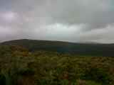
Well this was similar to Circuit of Glendalough in reverse! https://www.imra.ie/events/view/id/948And what a great circuit this is and despite only 4 checkpoints to visit, the planning was superb with a large choice of route options, particularly for first 2 legs. It was longer than than NC 1 and I was somewhat beyond my comfort zone in terms of time and it was great to finish in one piece!
The reference to Leg 5 is the Glendalough to Glenmalure section of the Wicklow Way Relay
Shared a lift with Terry again and we parked at the visitors centre, happy to have a warm-up run to upper lake carpark. What I hadn't figured was having to return when wrecked!!
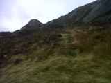
The weather which was damp in morning had dried up and the cloud lifting. We speculated that Mullacor and Camaderry may remain in cloud.
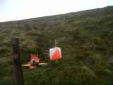
We were once again issued with custom waterproof maps and using SI, which is great for post race analysis.
Gavan gave his pre race brief...only 4 checkpoints for long, 5 for short!...with one maybe in wrong place...
Nav challenge 1 had free choice with order of checkpoints, this one was a fixed order.
Once we were off there were immediate questions, not least not getting confused with short course!The first checkpoint was on the SE side of Derrybawn. I dismissed going “Leg 5†route up via Pollanass Waterfall and travelled along Green Road back towards the visitors centre. Most of the other competitors seemed to travel this way as well. Finbar and Brian left quite soon which raised my eyebrows and headed straight up! I could see the logic, but I wasn't going to do it! Along the road I tried to work out what route to take but I had chosen not to put in contact lens and I couldn't see detail on the map without the compass magnifier, and I couldn't use this without stopping, so I guessed a bit what was on the map! For example the cliff to the right was actually a house! The others I was running with left the track here and I continued alone to a path that went straight up. I got on a path but it meandered to much to east and was not very straight! I eventually reached forest road and travelled along hoping to get on a path to right but none appeared and meanwhile I was loosing height which was alarming me. One of my key tactics in these long races is to minimise climb, which means not going down only to climb again! So after 400m of this I plucked the courage to head uphill, to wing it and hope for best. At this stage I was not sure where I was, but I had a feeling. I climbed up and then crossed a path, which was on course as part of my “feelingâ€. Continued climbing through bracken and bilberry and reached another forest road, which matched my feeling as well. I reckoned I was getting quite close and contoured around to come across a distinctive ruin. Dam! Where am I? Then I saw John Bell running down a track which was not in my view the other side of a line of trees. I got onto this track to see John punching the first checkpoint. My “feeling†was spot on!! 29:33 gone already. John had actually gone via Pollanass Waterfall.
But what of the ruin, well it is on map but concealed by the circle marking the checkpoint! Not the first time vital detail has been hidden by course marking.
I have to say I was quite delighted to see this checkpoint because my confidence in my “feeling' was waning, but my orienteering experience really stood to me.
I could see the route choices to checkpoint 2 without the magnifier so could read map on the run. A number of options presented themselves and I had my route sorted while climbing to no. 1. I had also looked further and checkpoint 3 looked a monster! Up and over Camaderry. This is going to be tough!
So the options to 2, go north of Derrybawn and go up The Spinc. Get to the ridge coming south from Derrybawn and then continue along ridge over Mullacor or drop into forest, or stay low keeping above forest and intercept where the Derrybawn ridge meets the Mullacor to Cullentragh ridge and then either go over Mullacor or go through forest.
As usual, my first thought is to avoid extra climb, so that ruled out Mullacor and The Spinc options. I took the latter option to continue along path and if going got tough, I could bail out and head up to the ridge. The forest route section was a definite. I conferred briefly with John and I thought this was his choice as well. The going was great along path, turning south between forest and the ridge. But John had disappeared. I thought he had headed up to the ridge. Actually John had dropped his map and had to go back for it! So lost some ground. Plenty of deer/sheep tracks meant the going was good all way till near Derrybawn River. From here the climb up the the path was quite bad and progress was slow and energy sapping. Eventually got to the intersection of paths to see others coming down the ridge from Derrybawn. I ignored the path and continued straight on to cut the corner, wondering would this confuse them! They did stop and then they were gone! I could see my prize about 300m ahead. This a gate into forest which signaled where the road started. Still no-one behind, so I assumed they had headed towards Mullacor.
The going across valley to this gate was bad, but I kept my focus on the gate and made way as best I could. I noticed John again, not knowing what way he came. Upon entering the forest, there was a low or high option. I reckoned the high had less climb. John took same option. 2Km later and I suddenly realised I was on leg 5 again, just before boardwalk. Where the road bends sharply, I went straight to intercept boardwalk and headed toward Lugduff. John took the longer option, so I gained a minute.. There was a bit of climb and I was starting to feel tired. Already 10k and well over the hour. As I approached checkpoint 2 and past 75minutes, I was thinking the 100 minute predicted winning time was mighty optimistic!! I reached checkpoint 2 and the long wait to wake the unit up confirmed that I was there first, but only seconds ahead of Finbar who came from The Spinc direction! Leg time 46:59!
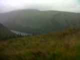
There was no avoiding climb to checkpoint 3 and only one route choice that I could see. Down into Glenealo Valley and the hard slog up to top of Camaderry. I went straight toward boardwalk, not sure which way Finbar went. On the whole the going was good but an attempt to take a more westerly line to cut the corner landed me in dense sedge and I had to get out of this and go straight to board walk. I saw John the other side of the dense sedge, so he had gained here. I got to foot bridge first and started the long climb. This is a case of trying to pick route of least resistance, picking deer/sheep tracks and the shortest vegetation. I saw a couple others crossing the bridge...but where was John??
I then saw him taking a different line further west, which seemed to me to be adding distance. He readjusted and headed back towards me. I was struggling up this climb and I knew the others were gaining, but I reached the top first. We then had a descent along the river to the river bend. Finbar passed me here as I was struggling to hold my right ankle which threatened to give way. The going along river which was good, turned quite rough but I managed a slightly better line to reached the checkpoint marginally ahead of Finbar 37:49.
Next leg was relatively short, but straight line was through two hefty cliffs. So the options were to go up across the top, or go below. I couldn't face climbing...and couldn't face loosing height....so went straight! I saw Finbar heading up, taking what I reckoned was the sensible route. The going was good and I was happy just to run after the slog of the up and over Camaderry. Then I reached the cliff....I scrambled through, getting a feel of the life of goats, with sheer drops a step away. Found gaps where I could slide down on my backside hoping for solid ground below. I managed and then reached the 2nd cliff. There was no scrambling down this one! And I made my way across top only for Finbar to appear in front of me. I had already sighted the checkpoint some 500m away, but a big valley in between. We both contoured around to checkpoint with Finbar quickly putting time between ourselves. 12:40
Finbar then headed up towards path home to Glendalough and I thought, he's moving much better, so if I have any hope of catching him, I need to try something different. So I went straight to avoid the climb and contoured to path, only to see Finbar disappearing ahead of me. So no chance of first unless he misses the steep path towards car park which I thought very unlikely.
Descent are not a strong point and when very tired and ankles struggling to hold up and important competition coming up, I played 100% safe. I was confident in my spiked shoes and these helped on the rocky slippery sections. Abut half way down, I was joined by John. I told him to let me know when he wanted to pass so I could make way. But he held position for a while and chose his moment to pass not far from bottom and we finished seconds apart in 2nd and 3rd not long behind Finbar in first who also took the decent carefully.
Thanks to Gavan and helpers for a great challenge.
My route
http://connect.garmin.com/player/372617874
18.5km 965m climb 140:27 minutes.
Start to 153; 29:33
-150; 46:59
-180; 37:49
-177; 12:40
-Finish; 13:26
Total, 140:27