Irish Mountain
Running Association

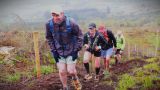
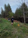
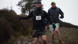
Brandon hill Half (Kilkenny)

Description:
Mt Brandon Half (Kilkenny)
County:
Kilkenny
Date:
Saturday 27th April, 2024
Time:
11:00
Climb (m):
870
Distance (km):
21.20
Event Difficulty:
9 (3,3,3) - Difficult Terrain, >500M ascent, >10Km
Race Marking:
Route fully marked - Route fully marked
GPS Allowed:
No
Leagues:
Leinster Half-Marathon League 
Mandatory Kit:
Level B - Standard
  • Waterproof jacket
  • Hat or buff
  • Gloves
  • Whistle
  • Charged mobile phone with emergency number stored
  • Foil blanket, bivvy bag or equivalent

All runners must bring the above items to the race. The actual kit to be carried during the race will be finalised on the day, depending on conditions etc., and clearly advised at Registration.

You should also have the means to carry all the kit in case required.

Failure to have the required items may lead to you being denied entry to the race, or disqualification. Random checks may be carried out.

Route Description:
https://strava.app.link/RscDH8ueOIb Starting just above the forestry barrier at Raheendonore carpark, runners will proceed up the fire road for 400 meters, hang a right and follow the fire road for a further 400 meters before going left, uphill onto a section of fire break. This is a little technical and has 2 nice little climbs over about 1.1km. You are now 2km in. Then at the top of a steep rocky incline, go right to follow the fire break for about a kilometer until on your right there is a gate and a metal stile. From here runners meander downhill on fire road for about 2km (not taking the right hand turn 500 meters down) until at a cross they go left, another kilometer up this forestry road there is a gap in the trees and a ditch to cross before a small drop to a shallow stream crossing. You are now about 6km in. From the stream its uphill on firebreak for a little over a kilometer ignoring the right hander just above the stream and the left hander near the top of the hill. The route then drops down to another section of often wet fire break, at the T junction at the bottom of the hill go left and slightly uphill, cross the second shallow stream, and run the 500ish meters of flat firebreak to begin your ascent to the top of Brandon hill. You are now 9 km in. The ascent starts with a steep climb up fire break for about 700 meters before turning left and onto the open mountain for a steep but runnable 1.5km ridge line run to the summit. Once you hit the summit you are over half way around the course. From the summit stay left for the descent down the rocky pilgrim path and at the bottom of this go right to contour around the hill on a section of fire break. At the next cross you’ll be directed right down another often wet fire break but cast your eyes left here to see the hill that you will face with 3km to go. At this point you are 12.5km in. Off down this firebreak you go for about 2.5 kilometers of undulation with some steep descents, with no turns until you hit the fire road, where you turn a sharp left to zigzag for about 800 meters to the lowest point on the route Before a gradual climb back up the fire road for about 2.2km. You are now about 18km in. You’ve probably enjoyed the hills and flowy descents of Brandon hill thus far. I’m afraid I can’t let you leave Kilkenny without some hardship. You’ll now climb the boggy ascent you saw from the 12.5km mark. It’s about 600 meters long with just under 200 meters of vert. It’s usually wet at the start and usually mucky throughout, but at the top you have finished climbing for the day. You now have about 2.5km to go. So at the top of the climb you’ll be directed through the gate on your right, about 300 meters through woods sees you out onto fire road, you now have 2.2km of downhill on decent fire road (do not take the right hand turn 1km down) to the finish, catch those infront of you, fend off those chasing you, Try to claim the much sought after “flying finish” segment on Strava if you’re that way inclined.
Getting There:
Race starts at Raheendonore Carpark. This is on the L4209 between Graignamanagh and Inistioge. The nearest eircode to the turn off for the carpark is R95 YF70
Organisers Instructions:
Carpooling would really be appreciated as parking is limited and it’s a popular spot.
Prizegiving Location:
Finish line
 

Volunteers (Non-Running)

You need to have done 2 non-running volunteer roles in a calendar year to qualify for end of year prize

Current Volunteers

Volunteers (Running)

Check with race director if they have a need for people volunteering and running. Race directors need a minimum number of people available throughout the race to make the race work so non-running volunteers are preferable. While it can be helpful, volunteering in a volunteer and race capacity does not count towards qualifying for end of year prize

Current Volunteers
RoleVolunteersAcceptedRun
HelperEoin PhelanYes
HelperCormac GreeneYes
 

Carpool

Driver NameLocationPassing ThroughDepartureSeats AvailableSeats Accepted
Dara O'BrienGraiguenamanaghThe carpark at the start/finish is small so if people can park in Graiguenamanagh at the rowing club car park, the Fairgreen carpark or at the hotbox sauna and carpool for there to the start (5km away) it would make things much easier. I can take 4 up with me and might be able to do a few shuttle runs. 086 0221627 for anyone who wants a lift.10:30:0040
Sean BuckleyGraignaghmanaghPick up point at hotbox sauna 9:45 0857671132 feel free to contact me any time. Will be travelling to Wicklow via New Ross after the race, if anybody needs a lift in that direction09:45:0042
Eoin HamiltonDun LaoghaireMonkstown, Leopardstown, Red Cow.08:00:0020
Laura-Anne MolloyTullamorePortlaoise then can either go via Kilkenny or Carlow (same suggested time and distance on Google Maps). Will be arriving for early start.07:30:0010
Anna CroninMalahideRed Cow and following the google maps route to Graiguenamanagh08:00:0032